Bahai Library Online

>   Maps
TAGS: Maps; United States (documents)
Notes:
Scanned by Kinko's for John Conkling.

See also Index to Maps and charts in Bahá'í World volumes.


Localities where Bahá'ís live (world, 1956):

detailed map

published in Bahá'í World, 
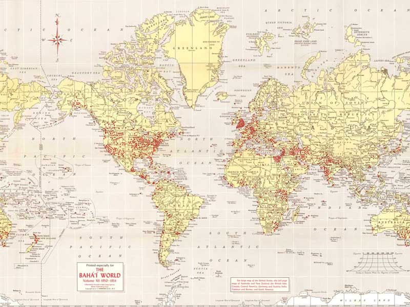
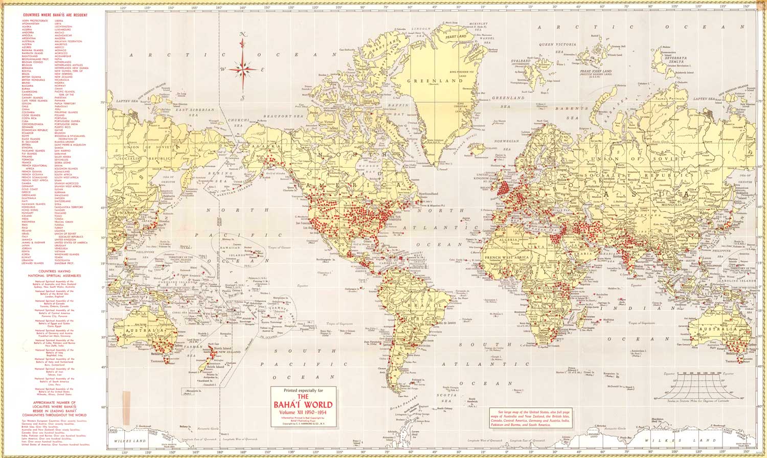
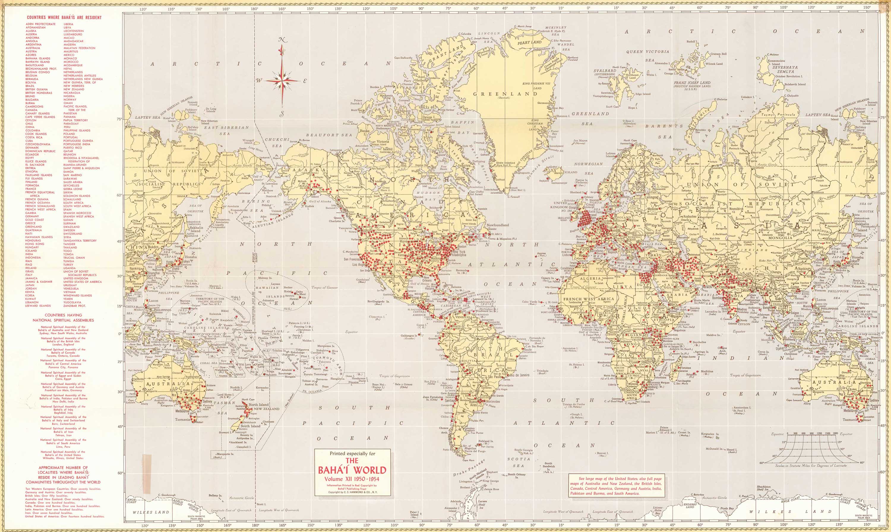
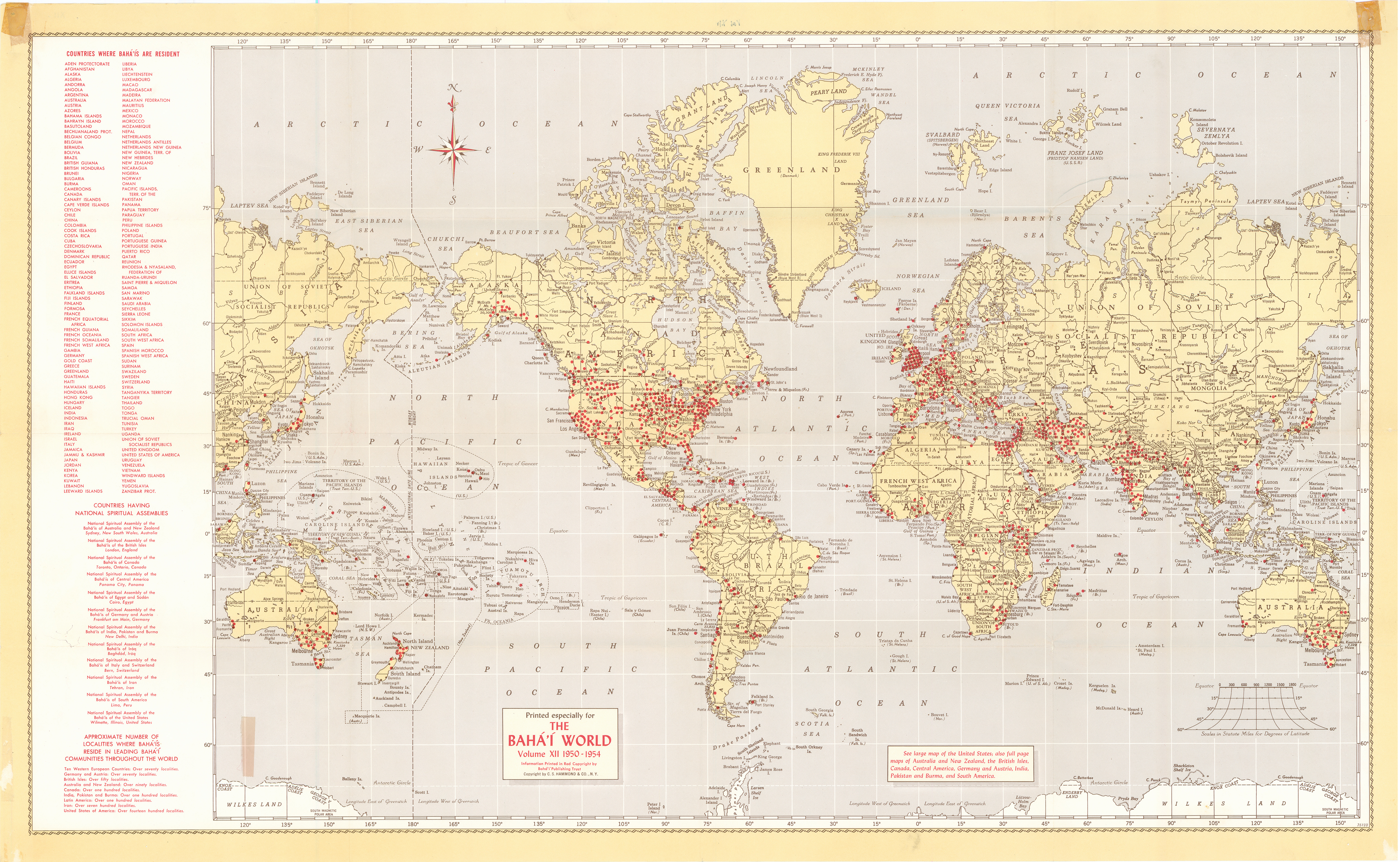
Vol. 12 (April 1950-1954)

Wilmette, IL: Bahá'í Publishing Trust, 1956

Click on one of the links below to see this image in different sizes. It was originally scanned at 600ppi and saved as uncompressed TIF, which I converted to JPG. The smaller versions have been lightly edited to improve contrast. To see the uncropped, unedited JPG file, click on the "Full" link below. Note: the Full image is huge, please try the smaller sizes first. The "Big" image should be large enough for printing. Original map measures 48 cm high x 78.5 wide.
Small1500x896 px215KB bw12_map5_localities_world_1956_small.jpg
Medium3000x1792 px746KB bw12_map5_localities_world_1956_med.jpg
Big3879x2317 px1.2MB bw12_map5_localities_world_1956_big.jpg
Full6183x3808 px9MB bw12_map5_localities_world_1956_full.jpg

preview image:

METADATA (contact us to help add metadata)
VIEWS8937 views since posted 2010-09-11; last edit 2010-09-11 UTC;
previous at archive.org.../map_localities_world_1956a
PERMISSION   © BIC, public sharing permitted. See sources 1, 2, and 3.
Home divider Site Map divider Tags divider Search divider Series
Chronology divider Links divider About divider Contact divider RSS
smaller font
larger font