Bahai Library Online

>   Maps
TAGS: Maps; Tablets of the Divine Plan
Abstract:
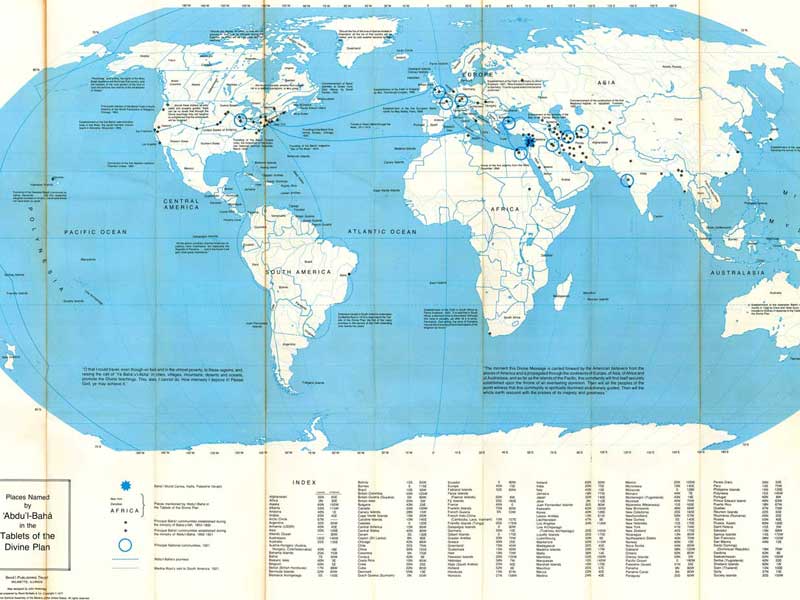
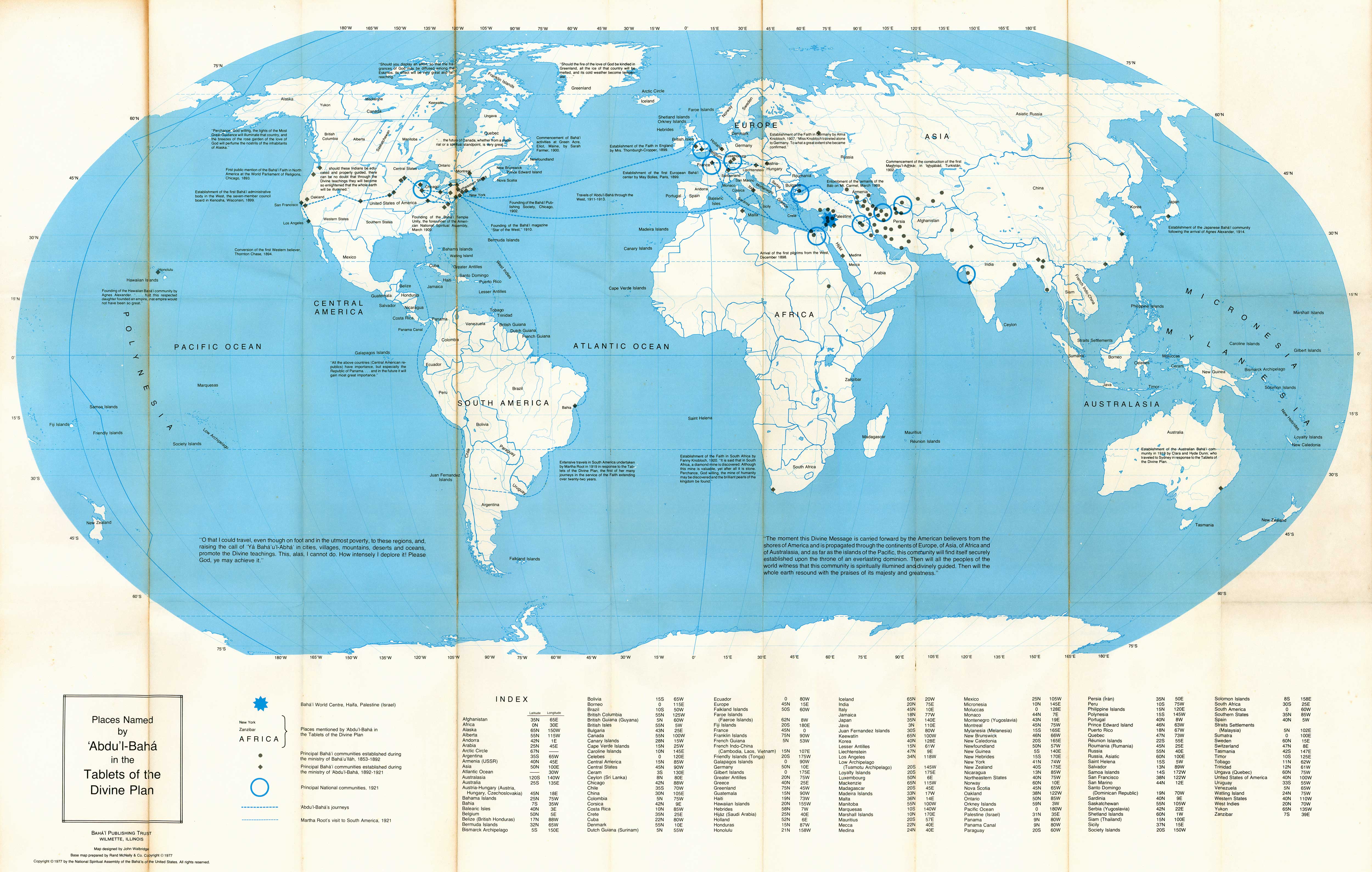
Map of the regions of North America named in Tablets of the Divine Plan, likely based on a 1912 geography book.
Notes:
Scanned by Kinko's for John Conkling.

See also Index to Maps and charts in Bahá'í World volumes.

Crossreferences:
https://bahai-library.com/divine_plan_maps;

Places named by ‘Abdu'l-Bahá in the Tablets of the Divine Plan

John Walbridge, comp.

published in Bahá'í World, Vol. 17 (1976-1979)

Haifa: Bahá'í World Centre, 1981

Click on one of the links below to see this image in different sizes. It was originally scanned at 600ppi and saved as uncompressed TIF, which I converted to JPG. The smaller versions have been lightly edited to improve contrast. To see the uncropped, unedited JPG file, click on the "Full" link below. Note: the Full image is huge, please try the smaller sizes first. The "Big" image should be large enough for printing.
Small1500x932 px157KB bw17_map1_places_named_abdulbaha_1977_small.jpg
Medium3000x1907 px615KB bw17_map1_places_named_abdulbaha_1977_med.jpg
Big5000x3179 px1.4MB bw17_map1_places_named_abdulbaha_1977_big.jpg
Full7263x4618 px14MB bw17_map1_places_named_abdulbaha_1977_full.jpg

preview image:

VIEWS8328 views since 2010-09-11 (last edit UTC)
LANG THIS English
PERMISSION   open copyright
Home divider Site Map divider Links divider Tags divider Chronology divider About divider Contact divider RSS